In photos: Cape Town’s flooded townships
June’s not over and already recorded rainfall far exceeds the month’s average
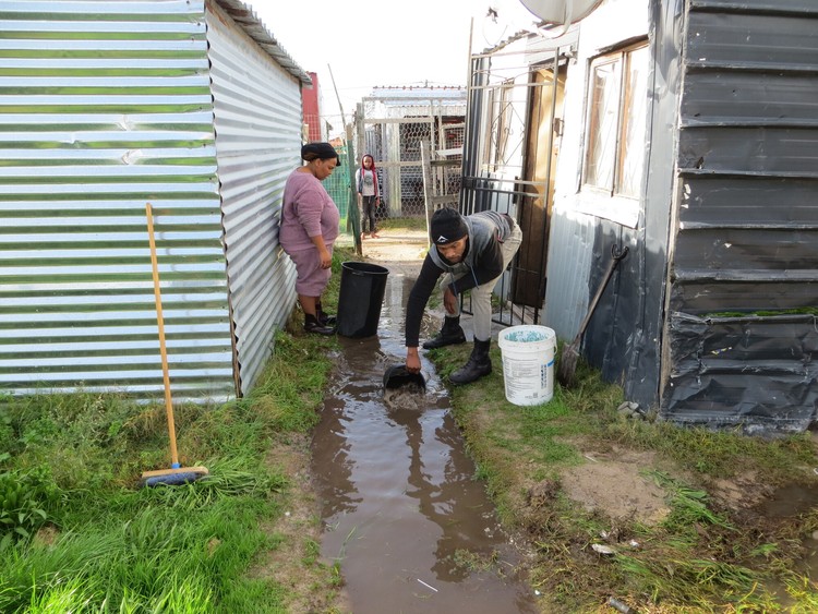
Phumla Ludid and Linduxolo Nguta remove water next to their shack in Sinazo informal settlement on Monday morning. Ludid said: “The water built up behind my shack during the heavy rain last night. It seeps into my shack and dams up under my bed and other furniture.” Photo: Vincent Lali
The amount of rain in Cape Town over the past few weeks is dramatically captured by the graph below published by the municipality, which shows the volume of the city’s major dams every week since 2018. Note what has happened in the last three weeks as represented by the dotted navy blue line.
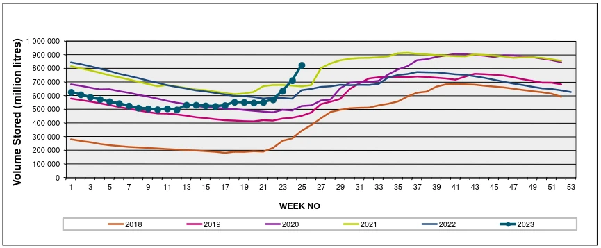
Volume stored in Cape Town’s dams by week since 2018. Note the sudden spike in the last three weeks in the 2023 graph. The dams are fuller at this point in the year than they have been for at least five years. Source: City of Cape Town
While rain is a relief for the drought-prone city, the deluge has caused much of the Cape Flats to become a wetland, flooding homes, and causing misery for many. Adding to this, the South African Weather Service issued a warning that the city will receive damaging winds on Monday.
The following table, also from the municipality, shows that rainfall recorded at all but one of the city’s dams (Steenbras being the exception) far exceeds the June average and the month is not yet over:
Rainfall recorded at the city’s dams. Source: City of Cape Town
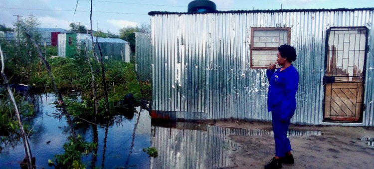
When she came back from nightshift Nkosiphendule Nzotho found her “shoes were swimming”. She lives in Gush’indoda informal settlement near Delft. Her shack is flooded and she has not been able to go to work for two days. “I might lose my job,” she said. Photo: Chris Gilili
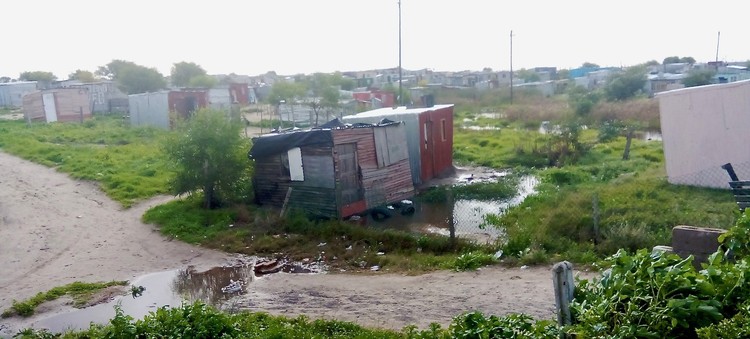
Gush’indoda informal settlement is a marshy bog this winter. Photo: Chris Gilili
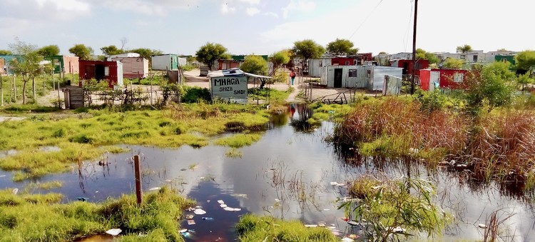
The community committee told people to relocate their shacks to less affected areas. Photo: Chris Gilili
About a dozen families are living in the KTC community hall, some having moved there last week. About 200 families have had to abandon their shacks in Nyanga. Pictured here, trying to keep warm, is Vuyolwethu Bonga and her six-month-old baby. Photo: Vincent Lali
Support independent journalism
Donate using Payfast

Next: New Lottery boss promises huge clean-up
Previous: Somali shop owners fear turf war between extortion gangs
© 2023 GroundUp. This article is licensed under a Creative Commons Attribution-NoDerivatives 4.0 International License.
You may republish this article, so long as you credit the authors and GroundUp, and do not change the text. Please include a link back to the original article.
We put an invisible pixel in the article so that we can count traffic to republishers. All analytics tools are solely on our servers. We do not give our logs to any third party. Logs are deleted after two weeks. We do not use any IP address identifying information except to count regional traffic. We are solely interested in counting hits, not tracking users. If you republish, please do not delete the invisible pixel.

