New plan for inner-city housing in Cape Town
City centre should accommodate up to 50,000 people by 2040
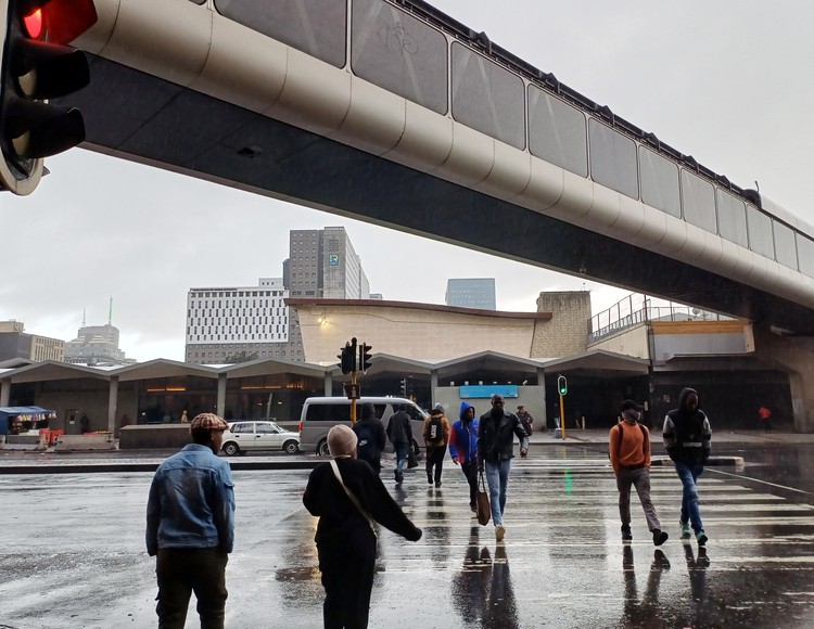
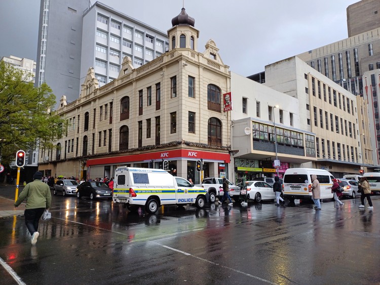
If the new inner city development plan is put into action, more people who work in the city centre will be able to live in it, instead of commuting each day. Photos: Steve Kretzmann
- According to the new Local Spatial Development Framework for Cape Town, about 40,000 more people should be accommodated in the inner city by 2040.
- This is because of population growth and the need for people to live near where they work.
- The plan says increasing housing will also make the inner city more vibrant.
- Key elements in the plan are pedestrian streets and the maintenance of links between the mountain and the sea.
A new framework for development of Cape Town’s inner city sets out plans to accommodate about 40,000 more residents in a greener and more pedestrian-friendly environment over the next 15 years.
The new Local Spatial Development Framework currently open for public comment, states that property in the inner city is unaffordable for 90% of Cape Town households who need accommodation. People who work in the inner city cannot even afford inner city rentals, and more than 70% of accommodation in the area is targeted at tourists. This includes guesthouses, flats let out for short-term rental through AirBnB, and hotels.
The inner city is the area between the Foreshore to the north and Orange Street in the south, and from Tennant Street in the east to Buitengracht Street and De Waterkant in the west.
According to the plan, there were 6,700 people living in this area in 2022. By 2040, the inner city needs to accommodate between 40,000 and 50,000 people, the plan says. This is because of population growth in Cape Town, and the need to give people – including working class people - the ability to live close to where they work. This will also contribute to the vibrancy of the inner city outside normal working hours. Currently, most of the city centre’s streets are almost deserted after 6pm and from Saturday afternoon until Monday morning.
While there is a huge demand for long-term accommodation in the inner city, especially among young people, there is not enough long-term rental supply, making it “extremely difficult to find affordable rental accommodation within the central city”. Affordable accommodation is defined as accommodation that households earning R22,500 or less per month can afford.
Since the Covid pandemic, demand for office space has been reduced, and office buildings can be retrofitted for residential use. New residential building is also needed, as the plan notes projected tourism growth will further limit the availability of long-term rentals. It also notes there are no policies to manage short-term rentals for tourists and the impact this has on the availability of accommodation for Capetonians.
In order to meet the challenge of increased supply and affordability, the plan says policy responses should target economic growth and increased employment to boost household income; there should be “general provision” of housing for all economic markets, along with “dealing with informality and homelessness”; and expanding spaces for “vulnerable people” to seek shelter in and around the inner city.
The plan suggests using underdeveloped and under-utilised parcels of land to achieve this. “It is imperative to create an inclusive residential affordability ladder,” notes the plan.
Housing developments
The plan provides a schedule of 23 residential development opportunities on public land in the inner city owned by the City, Western Cape Government, PRASA, and Transnet. These would supply an additional 18,000 residential units in the inner city, and are currently in various phases, ranging from identification to procurement.
The largest of these is a “mixed-market affordable housing development” on City-owned land forming part of the Foreshore Gateway Precinct, offering 3,480 residential units. Also on City-owned land, the Foreshore Freeways Precinct Development Project would offer 3,000 residential units. However, a study on the Foreshore Freeway Precinct, which has historically been a headache for the City, is not yet available to the public.
Also notable is the availability of two erven owned by the Western Cape Government at Prestwich Street in De Waterkant offering 1,080 residential units in a mixed use development. There are also a potential 1,785 residential units as part of a mixed-use development at Founder’s Gardens in Roggebaai, also on Western Cape Government land.
PRASA has two sites, the Ford showroom at Old Marine Drive, and the station deck, which could be developed to provide 1,135 and 1,479 residential units respectively.
Numerous other smaller sites of state-owned land are situated throughout the inner city.
The city’s pedestrian-friendly city blocks must be protected, the plan says.
The “unique setting and character” of the inner city is what makes it attractive to businesses, but the number of people who work in these businesses – more than other areas in the metropole - also drives demand for residential accommodation, which drives up property values. While City planners want to retain the inner city’s attractiveness for business in order to maintain and increase economic activity, this needs to be balanced with the need for tens of thousands more residential units while also protecting heritage and “upholding principles of good design”, the plan says.
The plan says it is important to protect the “fine grain” of the inner-city’s pedestrian-friendly city blocks between Riebeeck Street and Buitensingel Streets. The Foreshore, however, developed since the 1950s, consists of imposing city blocks and, with the unfinished freeways, is a challenge to the City’s vision of pedestrian-friendly blocks with interlinked public spaces. Given its existing characteristics, it is cited for skyscraper developments of 90m and higher. However, these need to be individually assessed for their shadow impact, impact on surrounding heritage features, and should be street friendly, with the towering upper storeys recessed from the street.
Mountain to sea
One of the key elements in the plan is establishing, or maintaining, links between the mountain and the sea, which is part of Cape Town’s unique sense of place. Where corridors cannot offer physical access due to the harbour, there should at least be visual links, the plan says.
Various parts of the inner city should become pedestrianised, such as Longmarket and Shortmarket streets which provide an east-west link between District Six and the Bo-Kaap, Long Street, and upper Bree Street, now known as “Breecinct”.
The provision of parking over public spaces (such as Harrington Square in the East City Precinct, and Heritage Square off Buitengracht Street) is discouraged, and a maximum number of parking bays need to be stipulated for new developments. Instead of catering for cars, the focus is on public transport, including micro-mobility in the inner city through tuk-tuks or other hyper-local solutions, with visitors from the suburbs being able to use park-and-ride options on the outskirts of the inner city.
Support independent journalism
Donate using Payfast

Next: Cape Town museum offers a window into life as a migrant worker under apartheid
Previous: Access to information: Public institutions are flouting the law
© 2024 GroundUp. This article is licensed under a Creative Commons Attribution-NoDerivatives 4.0 International License.
You may republish this article, so long as you credit the authors and GroundUp, and do not change the text. Please include a link back to the original article.
We put an invisible pixel in the article so that we can count traffic to republishers. All analytics tools are solely on our servers. We do not give our logs to any third party. Logs are deleted after two weeks. We do not use any IP address identifying information except to count regional traffic. We are solely interested in counting hits, not tracking users. If you republish, please do not delete the invisible pixel.


